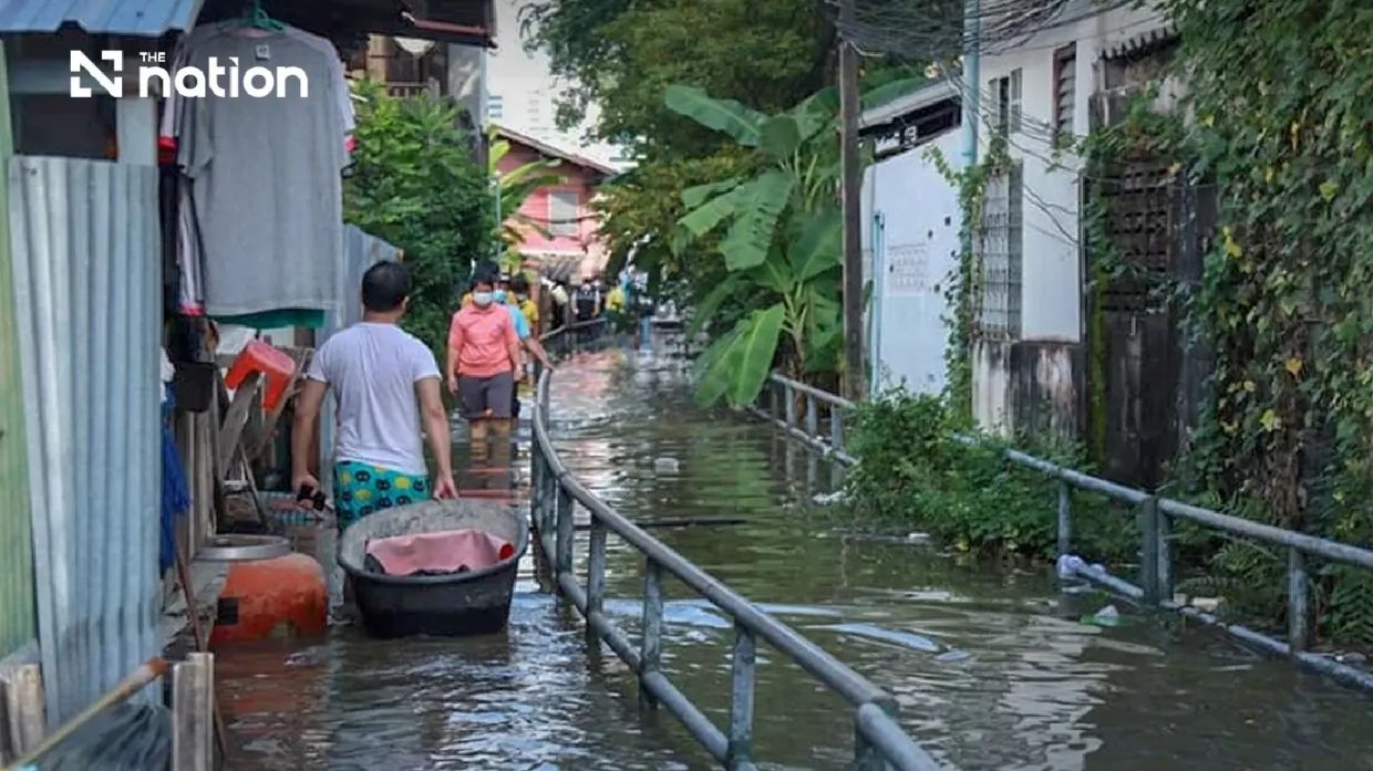
Thailand's Department of Disaster Prevention and Mitigation has escalated alert levels across Thailand's most densely populated region, placing Bangkok and six adjacent central provinces under watch for an extended high-tide event spanning an entire week. The warning, issued for the period between Monday, July 13 and Sunday, July 19, targets communities throughout Pathum Thani, Nonthaburi, Nakhon Pathom, Samut Sakhon, Samut Songkhram and Samut Prakan. This coordinated alert represents the kind of proactive crisis management that requires close coordination between national disaster authorities and local governments responsible for protecting Thailand's most economically vital areas.
Theerapat Kachamat, the director-general of the DDPM, made the announcement on Saturday, July 11 at noon, stressing that the forecast originated from rigorous analysis conducted by the Royal Thai Navy's Hydrographic Department. The naval agency had detected weather and oceanic patterns indicating that sea levels would surge significantly during evening hours, specifically between 6pm and 10pm each day throughout the warning period. This temporal precision allows residents and authorities to focus protective measures during the most vulnerable timeframe rather than maintaining constant vigilance across entire days.
The underlying mechanism driving the threat involves the interaction between high tides and freshwater discharge from Thailand's river systems during the monsoon season. The Chao Phraya River, which runs through Bangkok and feeds into the Gulf of Thailand, becomes particularly susceptible to backflow effects when oceanic tides push against the natural downstream current. The measurement point cited by authorities—Phra Chulachomklao Fort and surrounding reaches of the Chao Phraya—represents one of Thailand's most strategically important flood monitoring locations given its proximity to Bangkok's commercial districts and residential zones.
When seawater intrusion combines with elevated river discharge, the consequences ripple across multiple dimensions of urban and rural life. Riverbanks throughout the corridor are expected to overflow their natural confines, sending water into adjacent channels, canals and low-lying neighbourhoods. Communities positioned outside the permanent flood barrier infrastructure that protects Bangkok's core districts face heightened exposure, as do informal settlements and agricultural areas lacking dedicated flood defence structures. This unequal distribution of flood risk has long characterised Thailand's approach to water management, with wealthier urban areas receiving protective investment while peripheral communities remain vulnerable.
The six provinces falling under the alert encompass dozens of smaller administrative zones, each warranting distinct preparation. Within Pathum Thani, the districts of Mueang Pathum Thani and Sam Khok face elevated risk. Nonthaburi's vulnerable areas span Mueang Nonthaburi, Pak Kret and Bang Kruai. The agricultural province of Nakhon Pathom identified Bang Len, Nakhon Chai Si and Sam Phran as requiring heightened monitoring. Samut Songkhram, located at the mouth of the Mae Klong River, faces blanket alert status across all its districts. Samut Prakan's exposed zones include Mueang Samut Prakan, Phra Samut Chedi, Phra Pradaeng and Bang Bo. This granular designation enables local officials to mobilise resources proportionately rather than implementing uniform responses across entire provinces.
The Central Disaster Prevention and Mitigation Command has tasked provincial administrations with undertaking immediate public communication campaigns. Officials must broadcast precise timing information regarding high-tide peaks, allowing residents and business operators to time critical activities outside vulnerable periods. Floating restaurants that have become iconic features of Thailand's riverside culture must secure vessels and equipment, while construction projects involving riverbank reinforcement will need to suspend operations during the danger window. Local government units simultaneously maintain responsibility for alerting network partners including private-sector operators, neighbourhood leaders and community organisations positioned to cascade warnings throughout their constituencies.
Beyond immediate alert dissemination, authorities recognise that sustained situational awareness throughout the seven-day period will prove essential. The THAI DISASTER ALERT mobile application provides a centralised platform for distributing real-time updates without depending on traditional broadcast media channels. This technological approach acknowledges the reality that smartphone penetration throughout Thailand's central region now exceeds 70 percent, making app-based warnings potentially more reliable than sirens or loudspeaker announcements. The application's push-notification capacity ensures that even residents who are not actively monitoring news sources will receive critical information during their daily activities.
For those directly impacted by flooding or other water-related hazards during the period, Thailand has established multiple reporting channels reflecting lessons learned from previous disaster episodes. The LINE platform integration, accessed through the dedicated ID @1784DDPM, leverages the messaging application's ubiquity in Thai society to enable rapid two-way communication between affected individuals and emergency coordinators. The toll-free 1784 hotline operates continuously, ensuring that elderly residents, those without smartphones or citizens unable to navigate digital platforms retain access to emergency services. This multi-channel approach acknowledges the reality that comprehensive disaster response requires accommodating users across different technological comfort levels and demographic categories.
The timing of this alert carries broader significance for understanding Thailand's climate vulnerability during monsoon season. July represents the heart of the Southwest Monsoon period, when weather systems push moisture-laden air masses across the region and create conditions for both elevated rainfall and altered oceanic circulation patterns. High-tide events during monsoon months present compounded risk compared to events occurring during other seasons, as river discharge simultaneously increases while seawater intrusion pushes upstream. For Malaysia's region, comparable mechanisms during the Southwest Monsoon season create analogous risks along peninsular coastlines and river systems, suggesting that transnational knowledge-sharing regarding tidal hazard management could enhance preparedness across Southeast Asia.
The economic implications of this extended high-tide period merit consideration alongside the immediate safety dimensions. Thailand's central region encompasses manufacturing facilities, agricultural processing operations and logistics hubs whose operations depend on reliable water infrastructure and road access. Flooding that persists for hours each evening across multiple days can disrupt supply chains serving regional export industries. Farmers whose fields lie in flood-prone areas must protect crops and equipment during the vulnerable timeframe, adjusting planting and harvest schedules accordingly. Small traders dependent on daily river transport of goods face uncertainty regarding navigation window availability throughout the warning period.
Moreover, this episode occurs within a longer historical context of Thailand's struggle to balance development pressures against environmental constraints. Decades of upstream dam construction, downstream land subsidence in Bangkok, and ecosystem degradation in the Gulf of Thailand have cumulatively altered hydrological regimes in ways that amplify flooding risk. Each warning issued by disaster authorities implicitly reflects these systemic vulnerabilities that transcend any single meteorological event. Residents in affected areas recognise that high-tide alerts will likely recur with increasing frequency and intensity absent fundamental changes to water management policies and urban planning practices.

