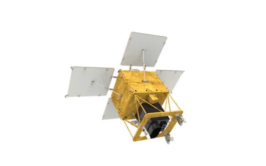
South Korea is moving forward with an ambitious space programme by launching its fourth medium-sized Earth observation satellite. The Korea AeroSpace Administration confirmed that a 500-kilogramme spacecraft will lift off aboard a SpaceX Falcon 9 rocket from Vandenberg Space Force Base in California on Tuesday at 4.10 pm Korea time, marking another milestone in the nation's growing capabilities in space technology and autonomous satellite development.
The satellite represents a significant step in Seoul's efforts to reduce dependence on foreign imaging systems and establish indigenous surveillance capabilities for national security and civilian purposes. With domestic payloads engineered and manufactured within South Korea, the spacecraft embodies the country's technological advancement in the aerospace sector, which has important implications for regional stability and economic development across East Asia.
Following separation from the launch vehicle approximately 2 hours and 22 minutes after liftoff, mission controllers expect to establish initial contact through the Svalbard ground station in Norway roughly 31 minutes later. This carefully planned sequence reflects the precision required in modern satellite operations, with each phase of deployment monitored through an international network of ground stations that support multiple space programmes simultaneously.
Once in its target orbit at an altitude of about 888 kilometres, the satellite will enter a four-month commissioning phase during which engineers will conduct extensive testing and calibration of all onboard systems. This deliberate approach to initial operations ensures that the platform performs reliably before transitioning to full operational status in the first half of next year, allowing ample time to validate imaging quality and sensor accuracy.
The satellite's primary imaging capability—photographing the entire Korean Peninsula every three days—provides significant advantages for monitoring regional conditions and changes. This frequency of coverage enables rapid detection of environmental shifts, agricultural developments, and infrastructure modifications that would be missed by less frequent observation systems. For Southeast Asian nations, the existence of such regional capabilities demonstrates the potential for developing indigenous Earth observation systems tailored to local needs rather than depending solely on established providers.
Beyond national security applications, the spacecraft addresses multiple civilian and scientific domains that directly benefit South Korean society and international cooperation. Agricultural monitoring through satellite imagery allows farmers and government agencies to assess crop conditions, predict yields, and optimise resource allocation across growing seasons. Forest management becomes more effective when managers can track vegetation changes, identify disease outbreaks, and plan sustainable harvesting operations with data updated regularly.
Disaster response capabilities receive a substantial boost from accessible, near-real-time satellite imagery. When floods, earthquakes, landslides, or other emergencies strike, emergency services can rapidly assess damage extent, identify affected populations, and prioritise rescue and relief operations. This capability holds particular relevance for Southeast Asian nations frequently exposed to typhoons, flooding, and seismic activity, where rapid situational awareness can save lives and reduce economic losses.
Climate change monitoring through consistent satellite observation contributes to understanding long-term environmental trends across the Korean Peninsula and wider East Asian region. Scientists can track urbanisation patterns, land-use changes, sea surface temperatures, and atmospheric conditions that collectively inform climate models and policy responses. Such data accumulation over years and decades builds irreplaceable archives that reveal otherwise invisible patterns in environmental transformation.
Public safety applications extend beyond disaster response to include infrastructure monitoring, urban planning support, and border security. Satellite imagery helps identify structural damage following natural disasters, track illegal construction activities, monitor water resources, and support conservation efforts. These applications benefit ordinary citizens through improved emergency response, better urban planning decisions, and more effective environmental stewardship.
South Korea's continued investment in its satellite constellation reflects confidence in space technology as essential infrastructure for modern governance and economic development. By the time this fourth satellite becomes fully operational alongside its predecessors, the nation will possess substantially improved persistent observation capabilities that can respond to national requirements without external dependencies. This progression toward autonomous space capabilities resonates throughout the region, as other Southeast Asian economies evaluate their own pathways toward technological self-sufficiency.
The successful deployment and operation of indigenous satellite systems also carries geopolitical implications. Countries demonstrating advanced aerospace capabilities command greater respect in international forums and enhance their strategic autonomy. South Korea's demonstrated competence in complex space operations contributes to the nation's technological reputation and economic competitiveness in high-value aerospace sectors.
For regional stakeholders and neighbouring nations including Malaysia, South Korea's growing space capabilities represent both opportunities and considerations. Collaborative opportunities may emerge around data sharing, joint research initiatives, or technology transfer agreements. Simultaneously, the existence of advanced observation systems underscores the importance for all regional nations to pursue technological development and secure their own strategic interests through comparable capabilities where feasible.