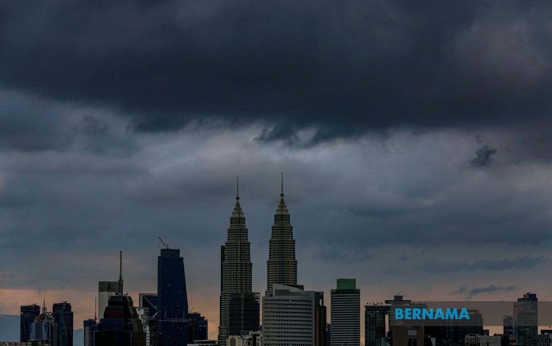
The Malaysian Meteorological Department has issued an urgent weather warning for thunderstorms, heavy rain and strong winds affecting Kuala Lumpur, Putrajaya and eight states, with conditions expected to persist until 4 pm. The alert represents a significant weather system moving through the peninsula and eastern Malaysian regions, prompting residents and commuters to take appropriate precautions during the afternoon period.
The Klang Valley, home to Malaysia's capital and over 7 million residents, faces the full brunt of the adverse conditions. Multiple districts across Selangor have been flagged in the warning, including heavily urbanised areas such as Hulu Selangor, Gombak, Petaling, Kuala Langat, Hulu Langat and Sepang. Given the density of infrastructure and human activity in these zones, disruptions to transportation networks and business activities are likely during the warning period.
Kelantan, Terengganu and Pahang in the east coast region are similarly affected, with specific districts identified as high-risk zones. In Kelantan, the affected areas comprise Jeli, Kuala Krai and Gua Musang, whilst Terengganu's warning extends to Besut, Hulu Terengganu, Dungun and Kemaman. Pahang, Malaysia's largest state by area, faces threats in Cameron Highlands, Raub, Bentong, Pekan and Rompin. This concentration of warnings across three east coast states suggests a weather system with considerable geographic reach.
Negeri Sembilan and Johor have also entered the warning zone, with the former state experiencing potential severe weather in Jelebu, Seremban and Port Dickson. Johor's extensive list of affected districts—Batu Pahat, Kluang, Mersing, Pontian, Kulai, Kota Tinggi and Johor Bahru—indicates that the southern region faces substantial risk. Port Dickson, a significant coastal tourism and business hub, warrants particular attention given its maritime economy and resident population.
Sabah experiences the warning across three distinct geographic zones: the interior divisions of Sipitang, Kuala Penyu, Beaufort and Tambunan; the west coast areas of Papar, Penampang and Ranau; and the Kudat region including Kota Marudu. This broad distribution suggests the weather system affects multiple elevation zones and climatic areas within the state, from coastal lowlands to interior highland regions.
Sarawak's warning extends across a similarly wide geographic band, encompassing Kuching, Serian, Samarahan and Sri Aman in the western divisions, alongside Betong (specifically Pusa and Betong), Kapit (Song, Kapit and Bukit Mabong), and Limbang. The inclusion of Kuching, Sarawak's capital and largest city, underscores the significance of this weather event for the state's economic and administrative centre.
Thunderstorms of this magnitude carry genuine risks beyond inconvenience. Heavy rainfall in short timeframes can trigger flash flooding, particularly in low-lying areas and districts with inadequate drainage infrastructure. Strong winds associated with such systems pose hazards to pedestrians, motorists and structural integrity of buildings. Commuters should anticipate traffic congestion and potential delays on major highways and within urban centres as weather conditions deteriorate.
The afternoon timing of the warning is noteworthy for Malaysian contexts. Heavy rain during the 4 pm window coincides with the end of working hours and school closing times, potentially creating convergence of peak traffic movement with adverse weather. Commuters relying on public transportation or driving home should allow additional travel time and exercise caution on roads where visibility may be significantly reduced.
Residents in affected areas are advised to remain indoors during the worst of the conditions if possible, secure any loose outdoor items that could be displaced by strong winds, and ensure drainage systems around homes are clear. Motorists should reduce speed, maintain greater following distances between vehicles, and avoid driving through flooded areas regardless of water depth perception. Coastal areas in Port Dickson and other maritime zones may experience rough seas, necessitating warnings to water users and boat operators.
The geographical spread of this warning across both peninsular Malaysia and East Malaysian states—from Kelantan in the north to Johor in the south, and encompassing Sabah and Sarawak—demonstrates a significant atmospheric disturbance. Such broad-based thunderstorm systems are characteristic of monsoon interactions or the passage of pressure troughs, which can generate severe convective activity across extensive areas simultaneously.
Businesses, particularly those in retail, transport and logistics sectors, should prepare for potential operational disruptions. Supply chain activities, courier services and delivery operations may face delays. Schools and educational institutions in affected areas may need to consider early dismissal or retention of students until weather conditions improve.
The four-hour warning window provides sufficient time for public preparation, though the afternoon concentration demands immediate awareness. MetMalaysia's issuance of this alert reflects the agency's confidence in the severity and likelihood of these weather conditions materialising. Residents should monitor official updates from MetMalaysia or local authorities for any extension or modification to the warning as the situation develops throughout the day.