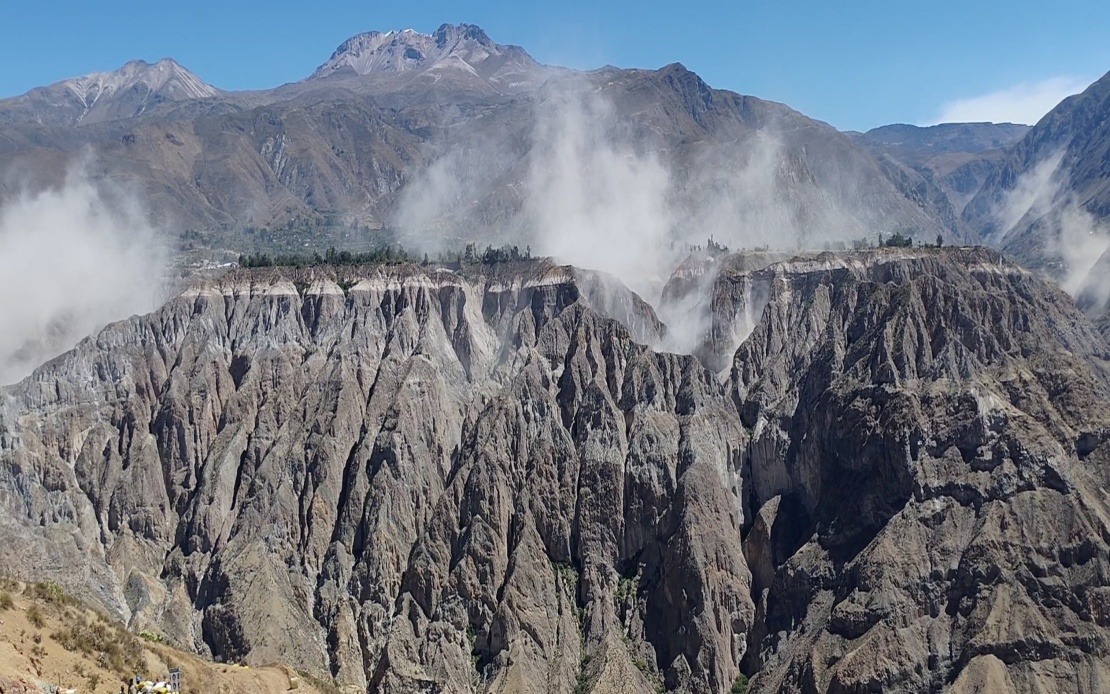
A significant seismic event struck southern Peru on Thursday afternoon, registering 6.7 magnitude according to the US Geological Survey, with the Geophysical Institute of Peru recording measurements of 7.2 magnitude for the same tremor. The earthquake occurred at 1 pm local time with its epicentre positioned approximately 35 kilometres north of Coracora in Parinacochas province, located within Ayacucho department. Initial reports from disaster management agencies indicate no deaths or major structural damage has been confirmed in the immediate aftermath.
The depth of the seismic event proved a crucial factor in limiting surface damage. At 108 kilometres beneath the earth's surface, the tremor lost considerable energy before reaching populated areas, resulting in intensity levels classified as light to moderate shaking according to seismic measurement scales. Geophysicists explained that intermediate-depth earthquakes like this one typically cause less destruction than shallow tremors of equivalent magnitude, as the additional distance allows seismic waves to dissipate more substantially.
People across a vast swath of Peru felt the earthquake's effects. Residents in southern and central regions reported clear shaking, with tremors perceptible even in Lima, the nation's capital city located hundreds of kilometres away. The widespread nature of the earthquake, despite occurring in a sparsely populated mountainous region, underscores the significant energy released during the event and serves as a reminder of Peru's vulnerability to seismic hazards.
This latest earthquake represents part of a broader pattern of seismic restlessness affecting Peru's northern and southern territories. Geologists have noted increased frequency of tremors across multiple regions, suggesting underlying tectonic systems remain active and potentially prone to further releases of accumulated stress. For residents and policymakers alike, this escalating activity pattern raises questions about long-term hazard preparedness and infrastructure resilience.
Peru's susceptibility to earthquakes stems directly from its geographical position within the Pacific Ring of Fire, the horseshoe-shaped belt of intense seismic and volcanic activity encircling the Pacific Ocean. This region encompasses approximately 75 per cent of the world's active volcanoes and generates roughly 90 per cent of its earthquakes. Nations positioned along the Ring of Fire, including Peru, Japan, Indonesia, the Philippines, and countries along North America's western coast, face recurring natural hazards that demand sophisticated monitoring and response systems.
Historical perspective underscores the catastrophic potential of major seismic events in Peru. The 2007 earthquake that struck the Ica region registered 7.9 magnitude and claimed nearly 600 lives, demonstrating how devastating earthquakes can be even when infrastructure standards have improved. That tragedy shaped Peru's subsequent approach to disaster preparedness and building codes, influencing construction practices and emergency response protocols across the country.
In response to Thursday's earthquake and the broader pattern of seismic activity, Peru's Geophysical Institute issued public guidance emphasizing the importance of sustained vigilance. Officials recommended that households review and practise evacuation procedures, ensuring all family members understand where to shelter and how to respond during shaking. The emphasis on preparedness reflects recognition that while authorities can monitor seismic activity, prediction remains beyond current scientific capability.
Emergency supply kits represent another cornerstone of the recommended preparedness measures. Authorities advised residents to maintain accessible emergency supplies including water, non-perishable food, first aid materials, flashlights, batteries, and essential medications. These kits enable households to sustain themselves immediately after seismic events, reducing dependence on overextended emergency services during the critical initial hours following major earthquakes.
For Southeast Asian readers, Peru's experience offers instructive parallels. Indonesia, the Philippines, and Malaysia all occupy tectonically active zones where earthquakes pose genuine threats to public safety and economic stability. The Pacific Ring of Fire extends through Southeast Asia, and countries in this region share Peru's challenge of balancing development imperatives with earthquake resilience. Understanding how Peru monitors seismic activity, communicates risk to the public, and maintains preparedness provides valuable lessons for regional disaster management authorities.
The Peruvian government's institutional response through agencies like the Geophysical Institute and the National Seismological Centre demonstrates the importance of specialized scientific institutions in natural hazard management. These organisations combine real-time monitoring networks with historical data analysis to provide the public and emergency planners with critical information. Investment in such infrastructure, though sometimes overlooked during periods of calm, proves essential when seismic events occur.
Thursday's earthquake, while substantial, fortunately demonstrated the protective effect of depth on surface communities. However, this fortunate outcome should not breed complacency. Continued monitoring and public education remain essential, particularly given Peru's seismic history and the region's active tectonic setting. As Peru navigates ongoing seismic activity, the nation's response mechanisms will continue facing real-world testing, with implications extending beyond its borders to other vulnerable populations throughout the Pacific Ring of Fire.

