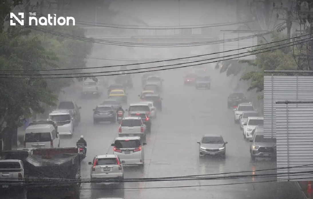
Thailand's Meteorological Department escalated its alert status on Wednesday, issuing its ninth consecutive warning as a monsoon weather system moves across the northern and northeastern regions, bringing the risk of dangerous flash flooding through Friday, August 21. The prolonged precipitation, combined with terrain features and existing ground saturation from earlier rains, poses particular hazards to communities in foothill areas, near waterways, and across low-lying zones where rapid water accumulation could occur.
The confluence of two dominant weather patterns is responsible for the intensifying rainfall. A monsoon trough is currently positioned across the North and upper Northeast, while a relatively vigorous southwest monsoon blankets the Andaman Sea, mainland Thailand, and the Gulf of Thailand. This combination creates particularly unstable atmospheric conditions that favour sustained and heavy precipitation across a wide geographic area. For residents across the affected regions, the key concern is not merely the intensity of individual rainfall events but the cumulative effect of continuous moisture inflow extending over several days.
The North faces the most severe conditions, with eight provinces designated for very heavy rain alerts. Mae Hong Son, Lampang, Nan, Phrae, Uttaradit, Phitsanulok and Phetchabun are all expected to experience exceptionally intense downpours, while an additional eight provinces including Chiang Mai, Chiang Rai and Sukhothai face heavy rain scenarios. Forecasters project thunderstorms to cover roughly 80 percent of the northern region from Wednesday evening through Thursday evening, with temperatures remaining warm, ranging between 22–34 degrees Celsius and southwesterly winds of 10–20 kilometres per hour.
The Northeast, equally vulnerable to the monsoon system, will also experience near-universal storm coverage, with thunderstorms expected across 80 percent of the region. Very heavy rain is anticipated in eight northeastern provinces including Loei, Nong Khai, Bueng Kan and Udon Thani, whilst a further dozen provinces from Nakhon Ratchasima to Ubon Ratchathani will face heavy rainfall. The warning system explicitly highlights the danger from accumulated runoff in this region, where several major river systems converge and drainage capacity can become overwhelmed during prolonged wet spells.
Beyond the primary danger zones, the wet weather pattern extends into the Central region and Eastern Thailand. The Central provinces of Nakhon Sawan, Phra Nakhon Si Ayutthaya and Kanchanaburi will see thunderstorms across 60 percent of their areas, with daytime temperatures reaching 32–36 degrees Celsius creating unstable atmospheric conditions. The East faces thunderstorm coverage of 70 percent, with the coastal province of Trat marked for potential very heavy rainfall and wave heights reaching two to three metres, increasing to three metres during severe storms.
For the Bangkok metropolitan region and surrounding provinces, although storm coverage is predicted at 60 percent, residents should remain alert for isolated heavy downpours, particularly in eastern and western suburbs. Temperatures will fluctuate between 25–27 degrees Celsius at night and 33–35 degrees during peak afternoon heating, with southwesterly winds of 10–25 kilometres per hour. The capital's drainage systems, though sophisticated, can experience localised flooding when intense rainfall occurs over short periods, especially in areas with older infrastructure or inadequate stormwater management.
The maritime implications are severe across multiple shipping zones. The upper Andaman Sea and upper Gulf of Thailand will experience dangerous wave heights of two to three metres, escalating above three metres during thunderstorm activity. The Thai Meteorological Department has issued explicit guidance that small boats must remain ashore through Friday, August 21, whilst all other vessels should navigate cautiously and actively avoid thunderstorm cells. The lower Andaman Sea faces slightly less extreme conditions with wave heights around two metres, though these could exceed two metres in areas of active storm activity.
Motorists and commuters require particular attention to route planning during this period. Roads with historical flooding records, particularly those crossing low-lying areas and passing through topographic depressions, could experience temporary but rapid inundation. The Thai Meteorological Department specifically advises against traversing such routes unless absolutely necessary, and only after confirming current conditions. Journey planning should incorporate significant time buffers to account for potential road closures, reduced visibility from heavy rainfall, and hazardous driving conditions created by standing water and reduced road surface friction.
The intensity and duration of this weather system reflects broader Southeast Asian monsoon patterns. For Malaysian observers, the situation in Thailand demonstrates how regional moisture flows can create synchronised weather systems across multiple countries. The southwest monsoon affecting Thailand typically brings similar precipitation patterns to northern Malaysia, though the concentrated topographic features of Thailand's northern highlands and the convergence zones in the northeast create particularly acute flooding risks. The Thai experience serves as a regional reminder of monsoon season preparedness protocols that remain relevant across the wider Southeast Asian monsoon domain.
Residents and authorities across the affected Thai regions are advised to maintain continuous monitoring of updated warnings and forecasts throughout the three-day period. Emergency response agencies have been placed on heightened alert, with pre-positioned resources in areas most susceptible to flash flooding. Community leaders in vulnerable areas should ensure residents understand evacuation procedures and know the locations of established safe zones. The meteorological department's frequent updating of its alert status reflects the dynamic nature of the weather system and the importance of real-time situational awareness during high-risk periods.

