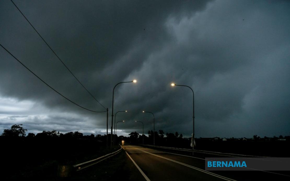
The Malaysian Meteorological Department (MetMalaysia) has cautioned residents and commuters across a significant portion of the country to prepare for severe weather conditions, issuing a comprehensive alert covering six states and the federal territory of Labuan. The warning, which came into effect on June 18, remains in place until 1 am the following day, indicating a sustained period of potentially hazardous atmospheric activity that could disrupt daily activities and travel plans throughout the affected regions.
In Peninsular Malaysia, the warning encompasses multiple districts across four states, creating a widespread weather system that spans from the north to the east coast. Kedah faces the threat in three specific areas: Padang Terap, Sik and Baling, where the combination of thunderstorms and gusty winds poses risks to agricultural operations and outdoor activities. The northern state's vulnerable districts are positioned strategically where geographic features can amplify wind speeds and concentrate rainfall.
Perak's involvement centres on the Hulu Perak district, a region characterised by forested terrain and river systems that can amplify flooding risks during heavy precipitation events. This area, situated in the state's interior, requires particular attention as mountain valleys can channel and intensify both rainfall and wind gusts. The warning here carries implications for rural communities and those dependent on river transportation or agriculture in elevated areas.
Kelantan, situated on the east coast and traditionally vulnerable to monsoon-related weather systems, faces the alert across five districts: Tumpat, Pasir Mas, Jeli, Tanah Merah and Kuala Krai. This spread across the state suggests a significant weather system moving through the region, with implications for both coastal and inland communities. The east coast's exposure to maritime weather patterns makes such warnings particularly consequential for fishing communities and those engaged in coastal commerce.
Pahang's Jerantut district joins the alert, adding the state's interior to the zones of concern. Located in the central part of the peninsula, Jerantut's inclusion indicates the weather system's broad geographic reach and the possibility of widespread impacts across Malaysia's diverse topography.
The warning extends significantly into Sarawak, encompassing fourteen separate areas that collectively represent a substantial portion of the state. The affected regions range from the capital Kuching through to Miri in the north, including inland areas such as Kapit and Sibu. This comprehensive coverage of Sarawak reflects the monsoon-influenced weather patterns affecting Borneo, where such systems frequently bring substantial rainfall to both coastal and interior divisions. The warning's reach across multiple divisions indicates a significant atmospheric disturbance with potential consequences for logging operations, river transport, and indigenous communities in remote areas.
Sabah faces the alert in three specific zones: Kuala Penyu in the interior, Putatan and Ranau on the west coast, and Telupid and Beluran in the Sandakan division. The distribution of affected areas across the state suggests weather system activity spanning from coastal to mountainous regions, with particular relevance to Mount Kinabalu's lower slopes and the surrounding communities that depend on seasonal weather patterns for agriculture and tourism.
Labuan, the federal territory strategically positioned off Sabah's coast, is also included in the warning, indicating that maritime and near-coastal areas face the same atmospheric challenges as the peninsula and Borneo. The inclusion of this offshore jurisdiction emphasizes the system's maritime dimensions and potential impacts on shipping, offshore operations, and coastal infrastructure.
MetMalaysia's decision to issue such a geographically extensive warning reflects the scale and severity anticipated by the department's forecasting models. Thunderstorms accompanied by heavy rain and strong winds pose multiple hazards including flash flooding in low-lying areas, disrupted power supplies from fallen trees or lightning strikes, and transportation challenges on both roads and waterways. For communities across the affected regions, the warning serves as a crucial notification to secure loose outdoor items, avoid unnecessary travel during peak storm activity, and remain alert to changing conditions.
The temporal limitation of the alert until 1 am suggests that forecasters expect the system to either weaken or move beyond the affected regions by that time, though the exact progression remains subject to meteorological developments. Residents and authorities would be wise to monitor subsequent updates from MetMalaysia, as atmospheric systems can sometimes intensify or persist longer than initially anticipated. The warning's precision in identifying specific districts rather than broad state-level alerts reflects modern meteorological practice, allowing communities to assess their specific vulnerability and prepare accordingly.
For Malaysian readers and those with interests across Southeast Asia, such weather alerts underscore the region's vulnerability to tropical weather systems and the importance of reliable meteorological services. The coordination of warnings across multiple states and territories demonstrates the integrated approach to weather forecasting that protects both life and economic activity across the nation's diverse geography.