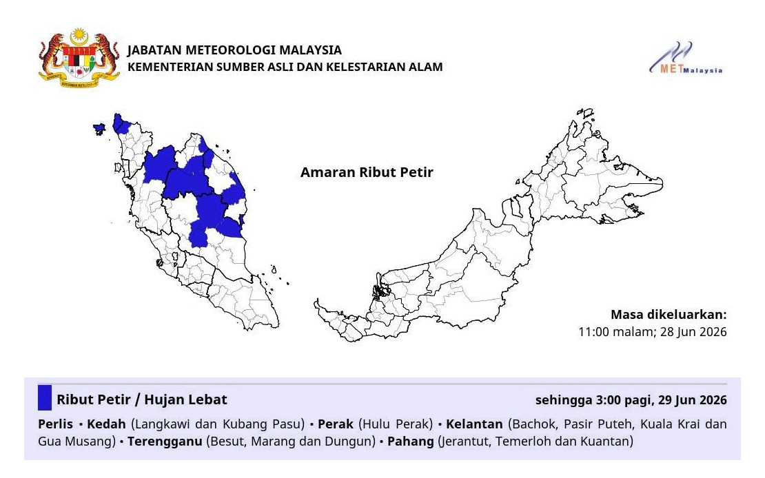
The Malaysian Meteorological Department has cautioned residents across a significant swath of the country's peninsula to brace for volatile weather conditions beginning immediately through the early morning hours. The alert, which remains in effect until 3 am, encompasses populated and rural areas spanning six states, reflecting a broad atmospheric disturbance affecting Malaysia's eastern corridor and central regions.
Perlis faces the full force of the impending system, with all districts at risk. Neighbouring Kedah is not entirely affected, with the warning limited to the districts of Langkawi and Kubang Pasu—both areas where the elevated terrain and coastal exposure make them particularly susceptible to severe convective activity. In Perak, the danger zone concentrates on Hulu Perak, the state's inland northern reaches, where mountainous terrain can amplify rainfall intensity.
The east coast bears the heaviest footprint of the warning. Kelantan's vulnerable zones encompass Bachok, Pasir Puteh, Kuala Krai and Gua Musang, a geographic spread that covers both coastal lowlands and inland hill country. Terengganu sees three districts placed under alert: Besut, Marang and Dungun, representing the northern and central portions of the state's coastline and interior. Pahang, Malaysia's largest state, faces elevated risk in three separate zones—Jerantut inland, Temerloh in the central corridor, and Kuantan on the coast—illustrating how the weather system is expected to strike across diverse elevations and latitudes.
The conjunction of thunderstorms, heavy rainfall and strong winds creates a compound hazard requiring serious preparation. Thunderstorms during overnight hours reduce visibility and make driving treacherous, while severe winds can dislodge unsecured objects, topple trees and damage poorly constructed structures. Heavy rain, the third element of the warning, carries distinct risks including flash flooding in low-lying areas, landslides on steep terrain, and waterlogging that can render roads impassable.
For residents in affected zones, the overnight timing of the alert carries particular significance. The window until 3 am means conditions will deteriorate through the late evening and persist through the pre-dawn hours when emergency response capacities are typically diminished and visibility is already compromised by darkness. Those in vulnerable locations—near flood-prone waterways, beneath large trees, in aging structures, or on exposed highlands—should consider precautionary measures immediately.
The scope of this alert demonstrates the increasing volatility that characterizes Malaysia's monsoon transition periods. While thunderstorms are routine during these months, the simultaneous warning across multiple states and diverse geographic zones suggests a particularly organised system or a regional weather pattern of unusual intensity. The easterly concentration of the alert reflects the typical moisture flows during this seasonal period, when warm, humid air masses feed convective systems that develop along Malaysia's eastern ranges and coastal areas.
Business and commercial operations should factor the warning into contingency planning. The early morning timeline means morning commutes could be affected, transportation networks may experience disruption, and outdoor activities should be postponed. Construction sites, outdoor markets, and events scheduled for the affected period warrant immediate review and potential postponement.
For agricultural communities across these states, overnight thunderstorms present a double-edged scenario. While rainfall benefits crops, the associated lightning, wind and potential flooding can cause significant damage to standing crops, temporary structures and vulnerable plantings. Farmers should ensure livestock are secured and that drainage systems in cultivation areas are clear to manage excess water.
The Malaysian Meteorological Department's issuance of this specific, time-bounded alert reflects the operational reality of tropical weather forecasting. Rather than issuing month-long general cautions, the agency issues targeted warnings when sophisticated modelling and radar analysis indicate genuinely hazardous conditions developing within a defined timeframe. Residents receiving this alert should treat it as actionable guidance warranting concrete preparatory steps rather than routine seasonal messaging.
Following the 3 am deadline, residents should monitor subsequent official updates for any extension or modification to the warning. Weather systems can intensify, persist longer than anticipated, or dissipate faster than forecast, making continued attention to official meteorological communications essential. Once conditions stabilise, communities in affected areas should assess any damage and address hazards such as fallen debris before normal daily activities resume.
This warning underscores the importance of maintaining situational awareness during Malaysia's volatile weather seasons. Residents in areas marked by the meteorological department should ensure they have access to reliable weather updates, know where to seek shelter, and understand local flood evacuation procedures. Preparedness during the hours preceding the alert offers the most effective risk mitigation strategy.