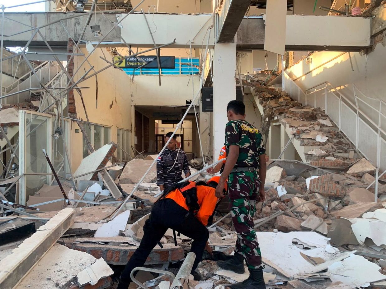
A magnitude 7.7 earthquake tore through Indonesia's Flores region early on Saturday, August 15, devastating the eastern province of East Nusa Tenggara and claiming at least two lives. The catastrophic temblor, originating 68 kilometers north-northwest of the city of Ende at a depth of 10 kilometers, struck at 5:58 a.m. local time and sent shockwaves across the island, triggering widespread structural damage and forcing anxious residents to flee their homes.
The undersea rupture triggered an immediate response from Indonesia's disaster management authorities, who swiftly issued tsunami warnings for multiple provinces including West Nusa Tenggara, South Sulawesi, and Southeast Sulawesi. Coastal residents were instructed to evacuate beaches and riverbanks and retreat to elevated terrain as a precautionary measure. However, the Indonesia Meteorology, Climatology and Geophysics Agency conducted ongoing monitoring of sea-level conditions and subsequently determined that no dangerous waves were developing, leading authorities to retract the tsunami threat assessment within hours of the initial quake.
According to preliminary casualty reports from the Maumere Search and Rescue Agency, the earthquake resulted in at least two confirmed deaths and two additional injuries. Beyond the human toll, the destruction proved extensive, with multiple buildings and residential structures collapsing or sustaining severe structural damage across the affected zones. The initial violent shaking was succeeded by several aftershocks that compounded community anxiety and complicated rescue and assessment efforts.
The seismic event created immediate chaos at medical facilities throughout the region. Hospital administrators evacuated patients from multi-story buildings as a safety precaution, fearing aftershocks could trigger additional collapses. Staff members hurriedly relocated beds, intravenous stands, oxygen cylinders, and other critical medical equipment to outdoor areas, establishing makeshift treatment zones to maintain emergency medical capacity amid the crisis.
Yohanna Embu, a Sikka resident whose regency is part of East Nusa Tenggara province, provided first-hand testimony about the devastation. She recounted observing numerous damaged structures throughout her community and described how frightened residents scrambled toward higher elevations seeking safety. Among the significant infrastructure losses she witnessed was the collapse of the waiting room at Maumere's port terminal, underscoring the intensity of ground motion that struck the region.
The tremor proved particularly catastrophic at St. Peter Major Seminary, locally known as Ritapiret Seminary and situated in Sikka on predominantly Catholic Flores. During early morning Mass, students and nuns were abruptly forced to flee their assembly hall as the roof gave way above them. Rev. Guidelbertus Tanga, the seminary's rector, revealed that the chaos and panic forced people to jump from buildings for safety, resulting in at least one priest sustaining a broken leg from a second-floor jump. The incident starkly illustrated the life-threatening conditions residents faced during the violent shaking.
Florian seismic activity reflects Indonesia's perilous position on the Pacific Ring of Fire, a vast arc encompassing some of Earth's most tectonically volatile terrain. This 40,000-kilometer zone of volcanoes and active fault lines encircles the Pacific Basin and accounts for approximately 90 percent of the world's earthquakes and 75 percent of active volcanoes. For Indonesia, an archipelago comprising over 17,000 islands, this geological reality means recurring earthquake and volcanic hazards represent an inescapable environmental feature.
Historical precedent underscores the catastrophic potential of large earthquakes in this region. In December 1992, a major earthquake adjacent to Flores triggered a devastating tsunami that killed approximately 2,500 people across the southeastern island, which forms part of Indonesia's eastern island cluster. That tragic episode established a sobering baseline for understanding the scale of destruction that seismic and tsunami events can inflict upon this vulnerable maritime population.
The August 15 earthquake, while powerful and destructive, fortunately avoided the compounding tsunami catastrophe that transformed the 1992 event into a mass casualty disaster. The rapid decision to lift tsunami warnings reflected genuine geophysical monitoring rather than complacency, as Indonesia's meteorological agencies employed sophisticated instrumentation to detect actual sea-level disturbances. This capability represents meaningful institutional progress in disaster response infrastructure since earlier decades, potentially averting considerably higher human losses than the two deaths initially recorded.

