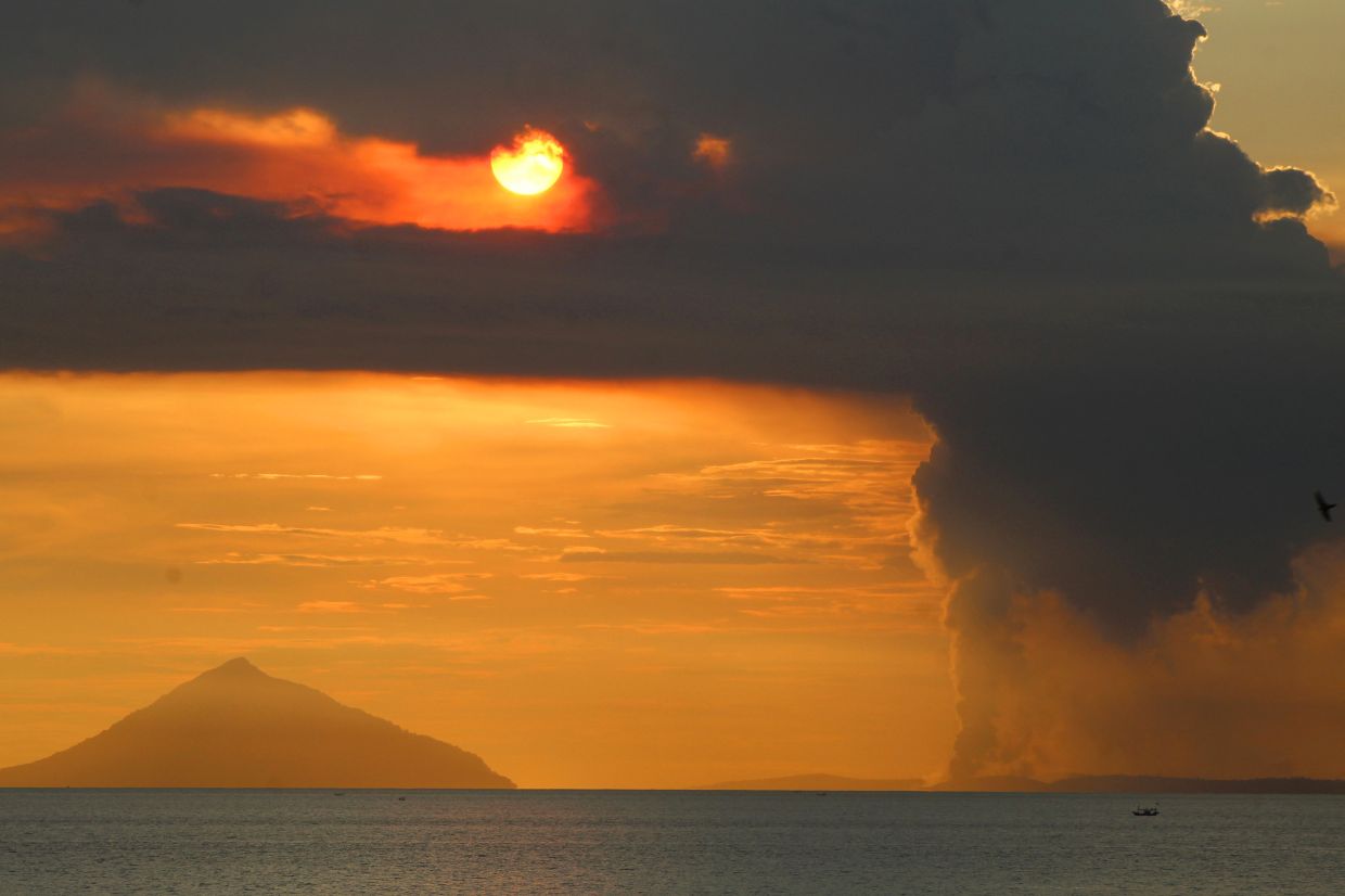
Indonesia's Mount Anak Krakatau demonstrated renewed volcanic vigour on Tuesday when it erupted at 8:21 a.m., producing a dense gray ash column that climbed 100 metres above the crater before drifting north-westward across the Sunda Strait. The eruption, captured by seismic instruments with a maximum amplitude of 11 millimetres and duration of approximately 15 seconds, marks the latest chapter in a dramatic acceleration of volcanic unrest that commenced in mid-June and has since transformed the volcano from a period of relative dormancy into an increasingly hazardous natural phenomenon.
The Geological Agency of the Energy and Mineral Resources (ESDM) confirmed the eruption details while authorities grappled with managing public safety in one of Indonesia's most strategically sensitive volcanic zones. Andi Suwardi, head of the Mount Anak Krakatau Observation Post in South Lampung, characterised the situation as fluid and unpredictable, noting that despite continuous eruptions with fluctuating intensity, the formal alert status remained unchanged at that moment. The contradiction between observable eruptive behaviour and official alert designation underscored the delicate balance authorities navigate between public reassurance and transparent hazard communication.
The volcanic awakening has progressed with remarkable speed since early June. Activity remained subdued until June 10, when instrumental monitoring detected the initial stirrings of unrest. Within days, the picture became dramatically clearer: between June 18 and 19, monitoring networks recorded more than 50 tremor events daily, a frequency that further accelerated through late June. By the period spanning June 16 to July 2, seismic stations documented an average of 97 volcanic earthquakes and tremor episodes per day, a velocity of activity that triggered mandatory escalation in hazard protocols.
On Friday, July 5, Indonesian authorities made the consequential decision to elevate Mount Anak Krakatau from Level II (Alert) to Level III (Watch)—the penultimate tier in Indonesia's four-stage volcanic alert framework. This reclassification, prompted by the unmistakable intensification documented across multiple monitoring parameters, precipitated the establishment of a three-kilometre exclusion zone encircling the crater. The eruption on Tuesday represented the fifth such event since the current eruptive phase commenced on Thursday, June 30, establishing a pattern of recurring volcanic discharge that demands continuous vigilance.
Despite official restrictions and warnings, the economic pressures facing communities dependent on the strait have created a persistent and troubling tension. Fishermen and tourism operators, facing potential income disruption, have allegedly continued accessing waters near the volcano whilst attempting to evade monitoring by government agencies. This behaviour reflects the harsh reality confronting maritime populations in the Sunda Strait region: volcanic hazards, whilst genuine and potentially catastrophic, must be weighed against the immediate necessity of earning livelihood. South Lampung Regent Radityo Egi Pratama acknowledged this predicament explicitly, appealing to fishing communities and tourism entrepreneurs to suspend operations voluntarily whilst emphasising that safety transcends economic considerations.
The historical context surrounding Mount Anak Krakatau amplifies the seriousness of current developments. The volcano itself emerged from the sea in 1927, gradually building itself within the caldera created by the catastrophic 1883 eruption of its parent volcano, Mount Krakatau. That nineteenth-century cataclysm ranks among the deadliest volcanic disasters recorded in human history, claiming approximately 36,000 lives across the region through the combined effects of powerful explosions and subsequent tsunami waves. The eruption's atmospheric impact was so profound that it disrupted global weather patterns and measurably influenced climate worldwide during the following year.
More recent precedent exists for the destructive potential that Mount Anak Krakatau possesses. On December 22, 2018, a partial collapse of the volcano's southern flank instantaneously displaced massive volumes of water, generating a tsunami that devastated coastal communities in southern Sumatra and western Banten province. The disaster claimed at least 429 lives with more than 7,200 injured, providing stark contemporary evidence of the cascade of hazards that volcanic instability in this location can unleash. The 2018 event demonstrated that Mount Anak Krakatau, despite its youth as a volcano, commands respect and careful management protocols rooted in painful experience.
Monitoring teams stationed at the observation post maintain round-the-clock surveillance, tracking ash plume dimensions, seismic parameters, and other indicators that might signal further escalation or, conversely, stabilisation. This continuous assessment provides the technical foundation upon which alert status decisions rest and offers the earliest possible warning should the volcano transition toward more dangerous phases of activity. Yet monitoring, however sophisticated, cannot entirely eliminate uncertainty: volcanic systems remain fundamentally unpredictable, capable of surprising observers with sudden changes in eruptive behaviour or intensity.
For Malaysia and the broader Southeast Asian region, the intensification of activity at Mount Anak Krakatau carries implications extending beyond Indonesian territorial waters. The Sunda Strait's significance as a major maritime thoroughfare means that any substantial volcanic event affecting visibility, air quality, or sea conditions could impact regional shipping and commerce. Furthermore, the historical pattern of tsunamis associated with Krakatau-system volcanism reminds neighbouring countries that volcanic hazards in this region transcend national boundaries. Malaysian maritime operators utilising the strait warrant awareness of current conditions and official updates from Indonesian authorities.
The challenge confronting Indonesian officials extends beyond the purely technical aspects of volcanic monitoring. Communicating hazard information to populations dependent economically on accessing dangerous zones requires sensitivity, clarity, and sustained engagement. The government's recognition that volcanic activity has disrupted local livelihoods—fishing and tourism operations form economic bedrock for South Lampung communities—signals understanding of the human dimension underpinning this crisis. Yet officials remain unambiguous: until volcanic activity subsides sufficiently to warrant alert downgrade, the exclusion zone and travel restrictions remain non-negotiable, regardless of economic consequences.
The unfolding situation at Mount Anak Krakatau exemplifies the complex interplay between natural hazards, economic necessity, and governance capacity in Indonesia's volcanic archipelago. As monitoring continues through the coming days and weeks, authorities will calibrate their response based on whether seismic activity stabilises, remains static, or accelerates further. The volcano's next eruption remains inevitable given current activity levels; whether that eruption remains confined to ash discharge or progresses toward more dangerous flank collapse scenarios that could generate damaging tsunami waves remains the question that haunts emergency management planners and the communities whose safety ultimately depends on their preparation and response.

