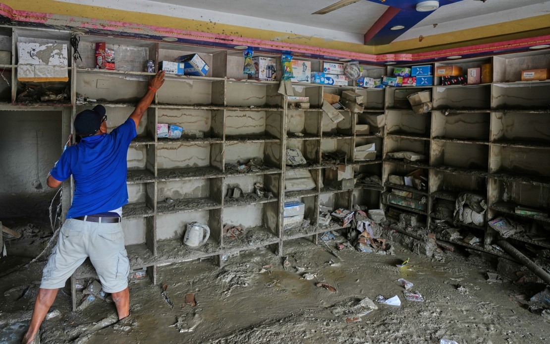
A major environmental disaster unfolded across the Nepal-China border when a glacier collapse in the Himalayas set off a devastating mudslide that swept through Gyirong Port in southwest China's Xizang Autonomous Region. Authorities have now pinpointed the exact cause following scientific investigation: a fracture in a glacier situated on the south slope of Mount Langtang Lirung in Nepal at approximately 5,200 metres elevation triggered a massive ice-rock avalanche that descended with terrifying velocity across international territory before causing destruction on the Chinese side of the border.
The sequence of events unfolded with alarming speed and power. Once the glacier fractured, the resulting avalanche plummeted toward lower elevations, and as it descended roughly 1,200 metres to around 4,000 metres altitude, the moving mass of ice, rock, and debris scraped and scoured the mountainside with increasing force. This mechanical action transformed the avalanche into a debris flow of extraordinary magnitude—what Chinese authorities describe as a massive mudslide capable of travelling vast distances. The torrent of material surged approximately 22 kilometres across the landscape before finally reaching Gyirong Port, situated at the comparatively low altitude of around 1,800 metres.
The physical destruction left behind testified to the overwhelming power unleashed. The mudslide flattened roughly 0.7 square kilometres of the port area, completely destroying 27 buildings and associated infrastructure in its path. As a key border crossing and trade gateway between Nepal and China, Gyirong Port serves vital economic functions for the region, making this disaster particularly consequential for cross-border commerce and connectivity. The scale of structural damage suggests residents had little warning and minimal opportunity to evacuate from the path of the advancing debris.
The human toll emerged grimly in official casualty figures released by the Xizang regional government. As of Saturday evening, at least 16 people had been confirmed dead, with 546 others reported missing in the immediate aftermath of the August 26 disaster. For a location like Gyirong Port, which functions as a working border post and commercial hub rather than a large population centre, these numbers represent a significant proportion of the transient and resident populations present. The large number of missing persons suggested rescue operations faced enormous challenges in locating and identifying victims buried beneath metres of compacted debris.
The scientific investigation into the disaster's origins involved sophisticated analysis and field expertise. A cryosphere emergency disaster response team operating under the Institute of Mountain Hazards and Environment, part of the Chinese Academy of Sciences, conducted detailed investigations into the event's mechanics. Their methodology combined remote-sensing monitoring data—satellite and aerial observations capturing the disaster as it unfolded—with field-transmitted data collected by instruments deployed in the region. Researchers also conducted on-site surveys and investigations to examine the terrain, assess the debris field, and trace the mudslide's path back to its source. This multi-layered analytical approach allowed scientists to reconstruct the disaster with considerable precision.
The incident represents a stark manifestation of how climate change and environmental degradation in the Himalayan region create cascading hazards that transcend national boundaries. Mount Langtang Lirung stands as one of several high-altitude peaks in the Langtang Range that scientists have monitored for signs of glacier instability. The fracture at 5,200 metres reflects the broader vulnerability of Himalayan glaciers to warming temperatures, which alter ice stability and increase the frequency of sudden collapses. For Nepal, which shares responsibility for managing these mountainous regions, such events pose particular challenges given the country's limited resources for glacier monitoring and hazard mitigation.
From a regional perspective, this disaster underscores the interconnectedness of environmental systems across Southeast and South Asia. The Himalayan mountain range generates hazards that travel far from their origin points, affecting communities in multiple countries simultaneously. For Malaysia and other Southeast Asian nations, this serves as a reminder that environmental challenges in neighbouring regions can have unexpectedly large consequences for regional stability and development. The mudslide at Gyirong Port disrupted a crucial trade corridor linking China with Nepal, potentially affecting supply chains and commerce throughout the region.
The incident also highlights the importance of cross-border scientific cooperation and early warning systems. Since the source of the disaster originated in Nepal but the primary impact occurred in China, the response required coordination between both nations' authorities. The presence of Chinese scientific teams capable of rapid deployment and advanced analysis demonstrates China's investment in disaster response infrastructure, yet also raises questions about whether Nepal possesses equivalent capacity to monitor and predict such events on its territory. For the broader region, developing coordinated glacier monitoring networks and shared early warning protocols could potentially save lives in future events.
The investigation findings released by Xizang's regional government through a formal press conference represented an attempt to establish clear accountability and scientific causation rather than speculation. By identifying the precise location of glacier fracture and tracing the debris flow path, authorities provided transparency about the disaster's mechanics. This approach contrasts with situations where such disasters are attributed vaguely to "natural causes" without specific investigation. The detailed findings also serve professional purposes for engineers and urban planners tasked with assessing risks to infrastructure projects in similar high-altitude border regions.
Looking forward, this disaster carries implications for infrastructure planning and settlement patterns in vulnerable border regions. Gyirong Port's location in a valley subject to debris flow hazards raises fundamental questions about whether such facilities should be relocated, protected with engineered defences, or maintained with enhanced evacuation protocols. Similar considerations apply to other settlements in the Himalayan foothills across Nepal, Bhutan, and India. For Chinese and Nepalese planners, the incident demonstrates that even established infrastructure cannot be presumed safe from natural hazards without rigorous geomorphological assessment and hazard mapping.
The convergence of glacier instability, extreme topography, and human settlement in this region creates what geographers term a "hazard-prone landscape." As global temperatures continue rising, such disasters may become more frequent rather than exceptional occurrences. For Malaysia's scientific community and policymakers, monitoring this situation and the regional response provides valuable lessons about preparedness in mountainous terrain, disaster response coordination, and the long-term implications of climate-driven environmental change affecting neighbouring regions. The Gyirong Port mudslide ultimately demonstrates that in an interconnected world, environmental hazards respect no borders and their consequences ripple far beyond their immediate source.

